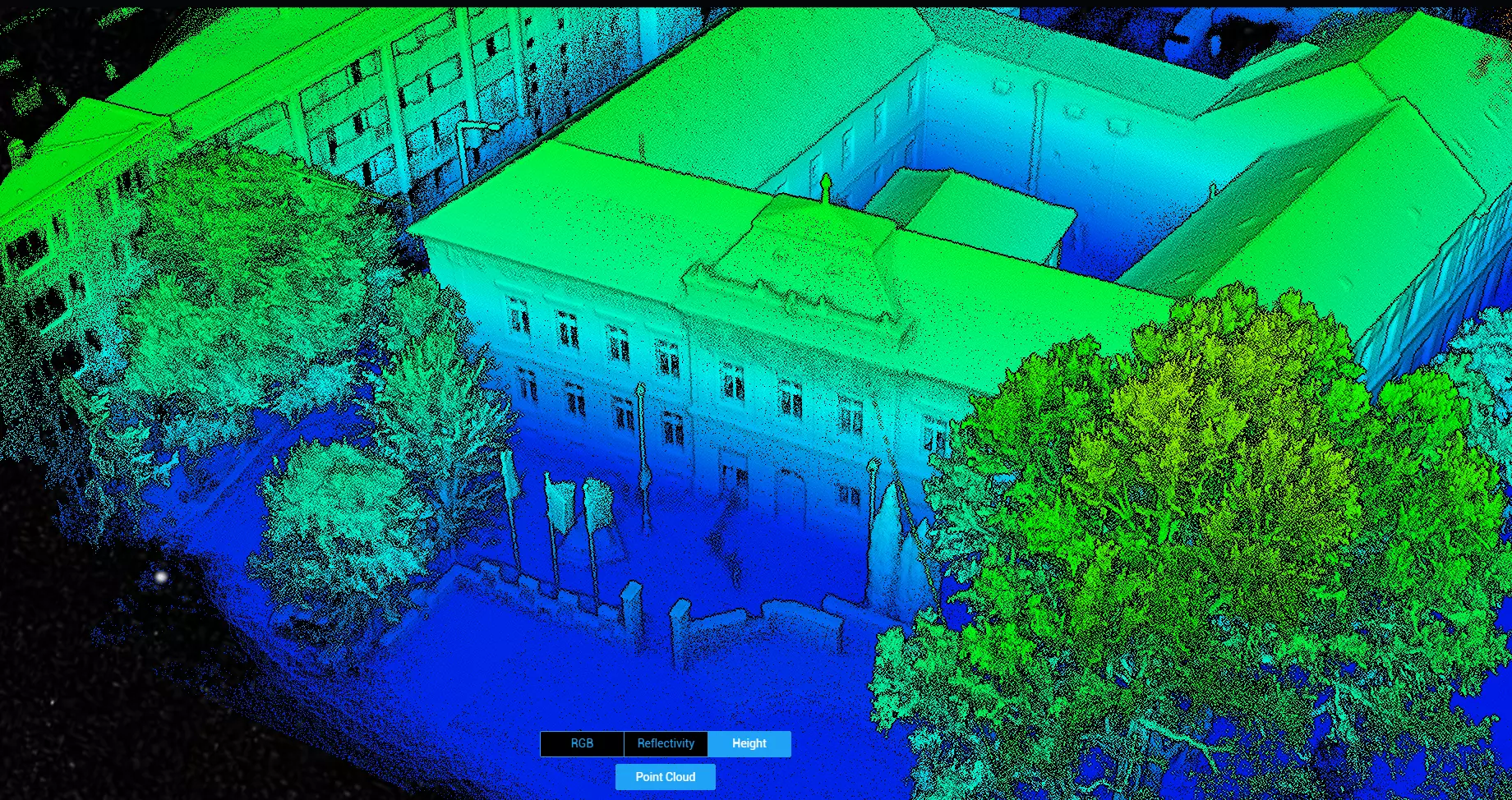
Using aerial laser scanning technology: measurements are carried out with a DJI Matrice 300 RTK drone and Zenmuse L1 camera. The camera is used to provide a highly accurate 3D survey of a site, engineering structures or building. The L1 camera is used to create a highly accurate point cloud. The format of the output point cloud is adapted to the software to be used (e.g. LAS, E57, RCP). The point cloud serves as the basis for an accurate 3D model.
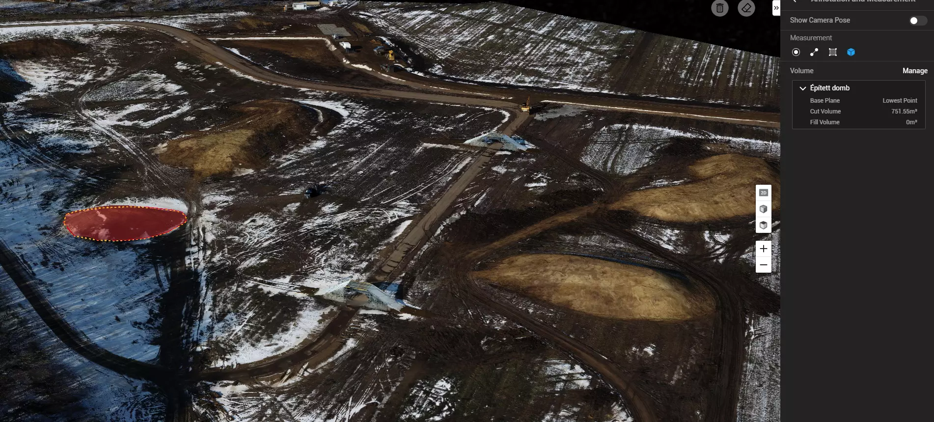
We also provide aerial surveys of areas using photogrammetry. Several hectares of land can be quickly surveyed, and from the surveyed areas, accurate measurements can then be made using a computer.